Reach to Xining
Your driver and your guide will pick you up at the airport and drive you to the hotel for the check-in.
Accommodation:Xining Changjiang Intl. Hotel
Meals:Not included
Xining—Ta'er Monastery—Chaka Lake—Chaka Town
Ta'er Monastery is located in the Huangzhong District of Xining, Qinghai Province. It was established in the 12th year of the Hongwu era (1379) during the Ming Dynasty. The monastery is named after the large silver stupa inside the Dajinwa Monastery, built in memory of the founder of the Yellow Sect (Gelug), Tsongkhapa. In Tibetan, it is called “Gunben Xianbalin”, which means "Maitreya Temple with the Buddha statue of ten thousand lion roars."
Ta'er Monastery is the religious center for Tibetan Buddhism in Northwest China and is renowned both in China and Southeast Asia. Throughout history, the central government has held Ta'er Monastery in high regard for its religious status. During the Ming Dynasty, the central government bestowed titles on senior religious figures at the monastery. During the Qing Dynasty, Emperor Kangxi granted the monastery the plaque "Jing Shang Jinliang", and Emperor Qianlong bestowed the title "Fanzong Temple", also presenting the monastery with the plaque "Fanjiao Fazhong" for the Dajinwa Monastery.
Several significant Tibetan religious leaders have visited or performed religious activities at Ta'er Monastery, including the 3rd, 4th, 5th, 7th, 13th, and 14th Dalai Lamas, as well as the 6th, 9th, and 10th Panchen Lamas.
Chaka Salt Lake is located at No. 9, Salt Lake Road, Chaka Town, Wulan County, Haixi Mongolian and Tibetan Autonomous Prefecture, Qinghai Province. The name "Chaka" comes from Tibetan, meaning "salt pond," while the Mongolian name "Dabushen Naor" refers to the "sea of green salt."
At an average altitude of 3,059 meters, Chaka Salt Lake covers an area of 154 square kilometers, with the scenic area itself spanning 30 square kilometers. This location is a crucial stop along the ancient Silk Road and the intersection of National Highway 109 and National Highway 315. It is 298 kilometers east of the provincial capital, Xining, and 200 kilometers west of Delingha, earning the title "Eastern Gateway to the Qaidam Basin."
Surrounded by snow-capped mountains, the tranquil surface of the lake mirrors the beautiful, enchanting sky, earning it the nickname "China's Mirror of the Sky." Walking on the lake’s surface feels as if you're walking on clouds. The water reflects the sky, which meets the earth in the distance, creating an almost surreal experience, as if one is strolling through a painting.
Chaka Salt Lake offers captivating views year-round. In spring, the low-hanging white clouds appear to fall into the lake, making it hard to tell whether the salt or the clouds are whiter. In summer, the lake’s emerald green waters ripple like a jade, refreshing and invigorating. In autumn, the dried lakebed is crystal clear and pure, vast and flat. In winter, the desolate, barren landscape presents a more challenging, yet striking, view.
Accommodation:Chaka Dongchen Intl. Hotel
Meals:All
Chaka Town—Qinghai Lake—Xining —Zhangye (High-speed train)
Qinghai Lake ( Tibetan: mtsho-sngon; Mongolian: Köke Naγur) is located in the northeastern part of the Tibetan Plateau, spanning the Haibei and Hainan Tibetan Autonomous Prefectures in Qinghai Province, specifically between the counties of Haiyan, Gangcha, and Gonghe. The lake stretches 106 kilometers from east to west and 63 kilometers from north to south, with a circumference of about 360 kilometers. Qinghai Lake is the largest inland saline lake in China, covering an area of 4,625.6 square kilometers and holding a water volume of 74.3 billion cubic meters.
As one of the highest lakes in the world, its surface elevation is 3,196 meters above sea level. The lake basin has an overall elliptical shape, sloping from the northwest to the southeast, forming a closed inland basin with a plateau continental climate. Qinghai Lake is a mildly saline lake with a high mineral content. The primary sources of water are rivers, followed by springwater from the lakebed and precipitation.
Qinghai Lake lies within the Tibetan cultural region, characterized by the shared cultural traits of the area, such as ethnic customs and cultural heritage, but also exhibits unique water-related cultural features. The region surrounding the lake is an important pastoral production base in Qinghai Province. It also has a certain scale of agriculture, tourism, and industrial production. Economically, the counties around the lake are primarily focused on secondary industries, with primary industries as a secondary focus, and the tertiary sector mainly concentrated along the lakeside highway.
Qinghai Lake is a typical representative of plateau inland lake wetlands, serving as a critical breeding ground and migration hub for waterfowl. It is also an important water conservation area and atmospheric water cycle corridor in western China, playing a crucial role in maintaining the ecological safety of the Tibetan Plateau. The lake acts as a natural barrier preventing the spread of desertification from the west, earning it the title of "climate regulator" and "air humidifier" for northwest China. Additionally, it is considered a genetic reservoir of species for the Qinghai-Tibet Plateau.
You will get a ride to the hotel after arrival.
Accommodation:Zhangye Shangjing Intl. hotel
Meals:Breakfast & Lunch
Zhangye—Giant Buddha Temple—Zhangye Danxia—Jiayuguan
In the history of Tibetan Buddhism, the period known as the "Post-Propagation Period" saw the rise of the "Three Virtuous Sages"—Tibetan figures Rao Sai, Yao Ge Jiong, and Mal Shakyamuni—who, after journeying from Tibet to Qinghai, established a monastery in the area now known as Jiao Chang Street in Xining. These three sages all passed away in Qinghai, with Yao Ge passing away in Xining.
In time, the local Buddhist community expanded the monastery significantly in honor of these figures. Inside the main hall of the monastery, large statues of the "Three Virtuous Sages" were created, and the monastery was named Dafo Si (Great Buddha Temple), becoming a significant site in the "Post-Propagation Period" of Tibetan Buddhism. It is renowned among the Tibetan, Mongolian, and other ethnic minorities in China and is revered by the faithful, who worship there with great respect.
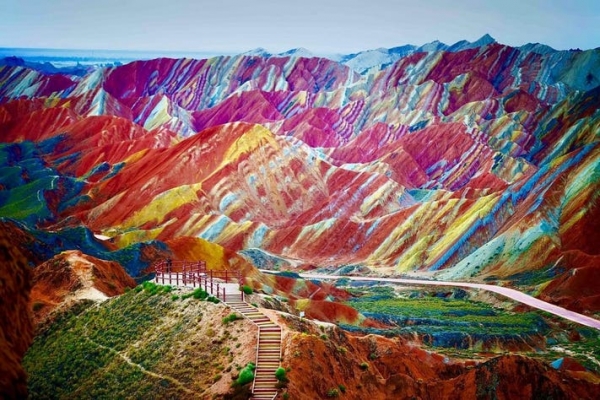
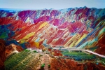
The Zhangye Danxia Landform is a unique type of landform, classified as part of the Danxia landform family, located in Zhangye City, in the central section of the Hexi Corridor in Gansu Province. Historically, it was part of Zhangye Commandery, one of the Four Commanderies of Hexi. The name "Zhangye" carries the meaning of "cutting off the arm of the Xiongnu (a nomadic tribe) and supporting China's side," symbolizing its historical and strategic significance.
The Zhangye Danxia Landform spans an area of about 50 square kilometers in the mountainous and hilly region, featuring strange shapes, vibrant colors, and majestic scenery. Danxia refers to the striking red sandstone peaks and steep, bizarre rock formations that result from long-term weathering, erosion by water, and the stripping away of surface materials. This particular Danxia landform in Zhangye dates back to approximately 200 million years ago, from the Late Jurassic to the Tertiary period.
Accommodation:Chenfeng Grand Hotel
Meals:All
Jiayuguan—Overhanging Great Wall—Dunhuang
Jiayuguan, known as the "First and Greatest Pass under Heaven", is located in the narrowest part of a mountain valley, 5 kilometers west of Jiayuguan City in Gansu Province. The city walls of Jiayuguan stretch across the desert and Gobi on both sides of the pass, with the Great Wall's northern extension connecting to the Black Mountain Cliff Wall and the southern section linking to the First Earth Mound. As the westernmost pass of the Ming Great Wall, it is historically referred to as the "Throat of Hexi," due to its strategic location and impressive architecture, earning the nickname "The Key to the Western Border." Jiayuguan was a vital transportation fortress on the ancient Silk Road and is one of the three major wonders of the Great Wall of China (with the Shanhaiguan Pass in the east, Zhenbeitai in the central region, and Jiayuguan in the west).
Construction of Jiayuguan began in the fifth year of the Hongwu Emperor's reign during the Ming Dynasty (1372). The fortress complex consists of an inner city, outer city, Luo city, Weng city, city moat, and the northern and southern wings of the Great Wall, extending for about 60 kilometers. The defense system is intricate, with watchtowers, forts, and battlements spread out in a strategic pattern. The fortifications are designed in overlapping defensive lines: five li (about 2.5 km) between beacon towers, ten li between fort mounds, thirty li between forts, and one hundred li between walled cities.
Jiayuguan is a UNESCO World Heritage Site, a 5A-rated National Tourist Attraction, a National Key Cultural Relic Protection Unit, and a National Demonstration Base for Patriotic Education. Major attractions include Jiayuguan Pass, the Cliff Wall of the Great Wall, the First Earth Mound, the Wei and Jin Dynasty tombs, the Black Mountain Stone Carvings, Mulan City, the "July 1" Glacier, and the Paragliding Base, among others.
The Suspended Wall of the Great Wall, as known as the Overhanging Great Wall, is located within Jiayuguan City, Gansu Province. It is about 11 kilometers from the city center of Jiayuguan and around 7 kilometers from the Jiayuguan Pass. The wall is named for its construction on a mountain ridge with an incline of approximately 45 degrees, resembling a suspended structure hanging in mid-air.
The Suspended Wall is an extension to the north of the Jiayuguan Pass and an important part of the ancient military defense system of Jiayuguan. Construction began in the 18th year of the Jiajing Emperor’s reign during the Ming Dynasty (1539). Built using locally sourced gravel and yellow earth, only 750 meters of the wall remain today. In 1987, it was repaired and is now made up of a path, parapets, and watchtowers. Two additional watchtowers were built at either end of the wall, making a total of three towers. The Suspended Wall is considered the final section of the Great Wall as it enters Jiayuguan and is often referred to as the "End of the Great Wall."
Accommodation:Dunhuang Zhongzhou Intl. Hotel
Meals:Breakfast & Lunch
Dunhuang Tour: Mogao Caves—Crescent Moon Spring
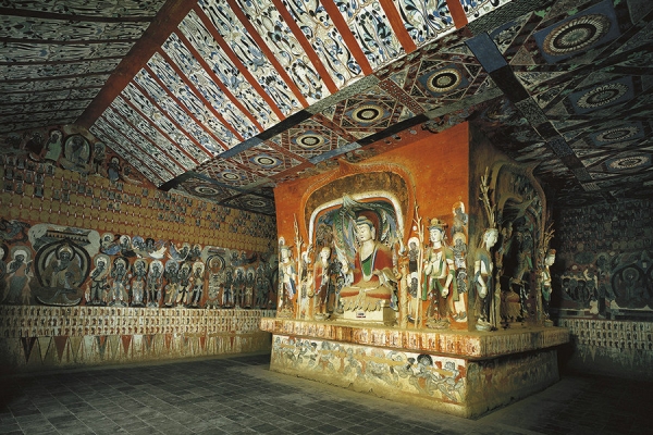
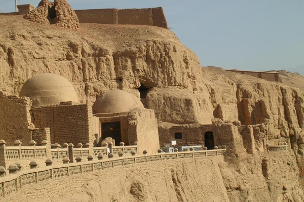
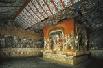
The Mogao Caves are a renowned Buddhist cave complex and a UNESCO World Heritage Site. Located at the western end of the Hexi Corridor in Dunhuang, they were excavated from the Sixteen Kingdoms period to the Yuan Dynasty, spanning nearly 1,000 years—an unparalleled feat among Chinese cave temples. The caves are not only a brilliant artistic treasure of ancient Chinese civilization but also an important testament to the dialogue and exchange between different cultures along the ancient Silk Road.
The Mogao Caves currently consist of 735 caves, housing over 45,000 square meters of murals and more than 2,400 colored sculptures. The site also features five wooden eaves from the Tang and Song Dynasties. It serves as a microcosm of the evolution of Chinese cave art, holding an esteemed place in the history of Chinese stone grotto art. Inside the caves, there are painted and sculpted Buddha statues and Buddhist scriptures, offering spaces for meditation, worship, and contemplation for practitioners.
The Dunhuang Caves are a synthesis of architecture, sculpture, and murals, forming a three-dimensional art form. The caves are divided into two areas: the southern area, with 492 caves, was primarily a site for religious activities, while the northern area, with 243 caves, served as residential quarters for monks and craftsmen. These northern caves contain facilities for living and practicing, such as earthen beds, flues, niches, and lampstands, but they mostly lack colored sculptures and murals.
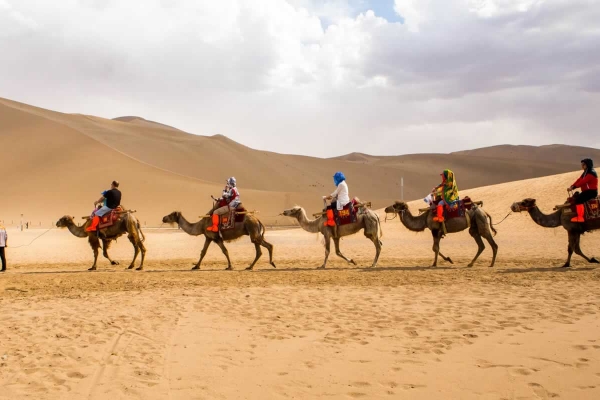
The Mingsha Mountain and Crescent Moon Spring Scenic Area in Dunhuang is characterized by a typical warm temperate arid climate. The Mingsha Mountain stretches 40 kilometers from east to west, from the Mogao Caves in the east to the Danghe River Mouth in the west, with a north-south width of about 20 kilometers. The main peak stands at an elevation of 1,715 meters. The mountain is formed by the accumulation of red, yellow, green, black, and white sands in five colors.
Crescent Moon Spring is nestled within the embrace of Mingsha Mountain and is named for its crescent moon shape. The spring is home to iron-backed fish and the medicinal herb Seven-Star Grass. The scenic area has three entrances: the Central Gate, the East Gate, and the West Gate. It is composed of six major scenic spots, with key attractions including the First Spring Stone Tablet, the Couple Willows, Crescent Moon Spring, Mingsha Mountain, and the Medicine King Temple ruins.
In 1994, the area was designated a national key scenic spot. In 2005, it was honored as one of China's Top Five Most Beautiful Deserts. In 2015, the site was rated as a National 5A Tourist Attraction and became part of the Dunhuang Global Geopark. By June 2024, the number of visitors to the scenic area surpassed 1 million, with online exposure reaching over 500 million. Visitors will stay in hotels after the tour.
Accommodation:Dunhuang Zhongzhou Intl. Hotel
Meals:All
Dunhuang—Turpan (High-speed train)
Today, you will be transferred to Liuyuan South Station to board the high-speed train to Turpan North Station. Upon arrival, your guide and driver will meet you at the exit and escort you to your hotel in Turpan (120 kilometers, approximately a 2-hour drive).
In the free time today, we will visit the Flaming Mountains, the filming location of the Journey to the West.
The Flaming Mountains are the most famous attraction in Turpan, located on the northern edge of the Turpan Basin. It is a key site along the ancient northern route of the Silk Road and also the filming location for Journey to the West. The mountains are renowned for their connection to the tale of the magical banana fan, and the surface, heated by the sun, seems to shimmer, resembling a soaring fire dragon. It is truly a spectacular sight. Afterward, you will check into your hotel in Turpan.
Accommodation:Turpan Hengze Hotel
Meals:Breakfast
Karez—Grape Valley—Jiaohe Ancient City Ruins—Turpan—Urumqi
Take a ride to visit the ancient water irrigation project, one of the three great engineering feats of antiquity, the Karez system. It visually demonstrates how the Karez system traverses the Gobi Desert, channeling underground snowmelt from the Tianshan Mountains to irrigate the surrounding oases. The Karez system is an ancient type of horizontal water collection structure used to harness underground water, typically in foothill or alluvial fan areas, mainly for agricultural irrigation and domestic water supply.
Afterwards, take a ride to visit the Jiaohe Ancient Village. The Uyghur Folk Museum and traditional residences in the scenic area complement each other, vividly showcasing the history, labor, architecture, customs, and religious beliefs of the Uyghur people. Many of these displays represent ancient and disappearing cultural elements.
Next, visit the Grape Valley Scenic Area in Turpan. This valley, located in Turpan, Xinjiang, is known for its abundant production of grapes. Locally, it is called "Buyiruk," meaning "a place with abundant and excellent grapes."
Return to Urumqi and check into your hotel.
Then, return to Urumqi, passing along the way by the largest wind power station in Asia—the Dabancheng Power Station. Hundreds of wind turbines stand tall, spinning gracefully in the wind, contrasting with the blue sky and white clouds. Against the backdrop of the majestic Bogda Peak, this vast and wild landscape forms a spectacular "world of windmills."
You will also pass the "Dead Sea of China"—Salt Lake, and the charming hometown of Wang Luobin, Dabancheng, which inspired many of his famous songs.
Accommodation:Urumqi Xinglong Intl. Hotel
Meals:All
Urumqi: Tian Shan Tianchi Lake—Urumqi Grand Bazaar
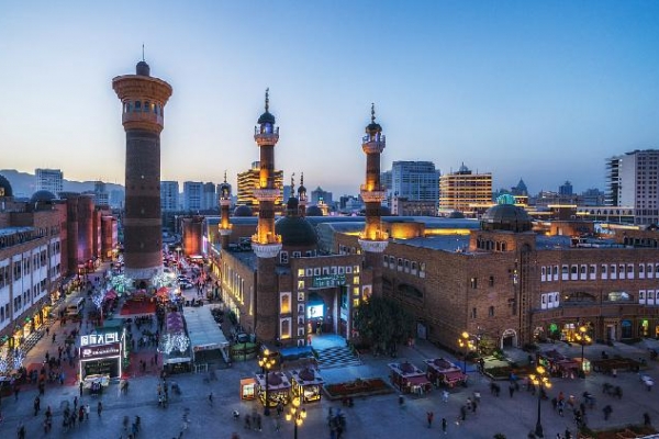
After breakfast, you will take a vehicle to the Xinjiang International Grand Bazaar, which was completed on June 26, 2003. It is the largest bazaar in the world (the word "bazaar" in Uyghur means market or trade fair). The Grand Bazaar integrates Islamic culture, architecture, ethnic trade, entertainment, and dining. It serves as a hub and showcase for Xinjiang's tourism products, functioning as a "window to Xinjiang," a "window to Central Asia," and a "window to the world." In 2004, it was selected as one of Urumqi's "Top Ten Buildings." The structure boasts a strong Islamic architectural style, blending functionality with a sense of the times, while also recreating the prosperity of the ancient Silk Road. It is a concentrated display of the rich ethnic features and regional culture of the western areas.
Afterwards, you will travel to the Tian Shan Tianchi, a representative of the natural landscapes of the arid region in the heart of the Eurasian continent. Tian Shan Tianchi is a UNESCO World Natural Heritage site, a national AAAA-level tourist attraction, a national geological forest park, a key scenic area promoted by the government, a national civilized scenic tourism area, and a biosphere reserve. It is also regarded as one of China's top ten scenic spots for resource protection, as well as the best choice for tourism in China. You will visit the unique and ancient elm tree at an altitude of 2,000 meters, known as the "Dinghai God Needle." After the tour, you will check in at a hotel in Urumqi.
Accommodation:Urumqi Xinglong Intl. Hotel
Meals:All
Drop-off in Urumqi: Ending the Tour/Reach to Kashgar
Your journey ends with the driver escorting you to the airport. From lakes to deserts, and finally reaching the highlands, your Silk Road adventure spanning three provinces comes to a close.
Accommodation:Not included
Meals:Breakfast
OR
You will take a flight from Urumqi to Kashgar. The reference flight departs at 09:55 from Diwopu International Airport (T3) and arrives at 12:00 at Kashgar Leining International Airport (T2).
Upon arrival, a dedicated airport pick-up staff member will be waiting to greet you. You will then be transferred to the hotel to check in and place your luggage. After a short rest, you will have the afternoon to explore Ancient City of Kashgar.
While exploring the Ancient City, there are several important attractions to visit. One of the highlights is the Aitigaer Mosque, which is one of the largest mosques in the country. The architecture inside is grand, and the five daily prayer sessions create an impressive and religious atmosphere.
On the eastern side of the Ancient City, you will find the old residential buildings, which are some of the preserved ancient urban structures. The mud-brick houses and cross-street buildings are particularly unique.
Across the river on the eastern side is the Kashgar East Bazaar (also known as the Central Asian International Trade Market). This bustling marketplace is famous in Kashgar, offering a wide variety of local specialties and handicrafts, including dried fruits, silk products, essential oils, and the famous Yengisar knives.
Afterward, check into the hotel to rest and prepare for tomorrow’s exciting journey to the challenging and magnificent Pamir Plateau.
Accommodation:Boman Intl. Hotel
Meals:Breakfast
Kashgar—Baisha Lake—Karakul Lake—Tiemenguan Wetland— Jincaotan—Taxkorgan
Baisha Lake and Baisha Mountain Scenic Area is located in Bulenkou Township, Akto County, about 150 kilometers from the county seat. Baisha Mountain is one of Xinjiang's unique landscapes, also known as "Echoing Sand Mountain." Whenever strong winds blow, the mountain produces a sound. In front of the mountain lies Bulen Kule Lake, and behind it is Chakulak Lake, both rich in water grass and abundant with waterfowl. The green mountain slopes are covered in white sand, partially hidden, with undulating ridges stretching across, creating a magnificent spectacle. This striking scene, with snow-capped peaks atop and lakes and rivers below, is breathtakingly beautiful, evoking the feeling of a paradise. Bulen Kule Lake is a wetland natural and cultural landscape in Xinjiang, with its name meaning "lake at the foot of the mountain" in Kyrgyz.
Karakul Lake is located at the foot of Mount Muztagh Ata, known as the "Father of Glaciers." The name "Karakul" comes from the deep and mysterious color of the lake, which means "black lake" in Kyrgyz.
In front of the lake lies a vast grassland. During spring and summer, the grassland is teeming with cattle and sheep, while the lake's surface is home to waterfowl and wild ducks. Occasionally, swans come here to forage. Under the sunlight, the lake water sparkles and reflects the majestic Muztagh Ata, creating a stunning display of colors. Local legends claim that there are water monsters lurking in the lake, but whether this is true remains unknown, as no one has ever seen them.
The color of the lake changes throughout the day with the shifting sunlight. Typically, the water is crystal clear, like a mirror. However, when dark clouds gather, the lake turns a deep, inky black, truly living up to its name "Black Lake." At sunrise, the surface of the lake shimmers and shifts in a way that feels almost magical, changing from deep blue to pale yellow to orange-red, giving the impression of a mystical wonderland.
Alar Jincaotan, centered around the Jincaotan Wetland Park, combines ecology, folk customs, and historical culture, creating the "Northern Kashi, Southern Tanta" tourism brand. Through the development of diverse tourism projects and infrastructure, it has fostered the vigorous growth of the tourism industry. The name Jincaotan, which means "Golden Grassland," comes from its abundant water grasses and the stunning sunset glow, making it a breathtaking destination that attracts many visitors.
Accommodation:Grand Hotel Pamir
Meals:All
Taxkorgan—Pamir Plateau—Panlong Valley Path—Bandir—Muztagh Glacier Park—Kashgar
The Panlong Ancient Road on the Pamir Plateau is located in Wacha Township, Tashkurgan Tajik Autonomous County, Kashgar Region. It is a famous "internet celebrity" road in the region. The road winds its way up the mountains, with its serpentine twists and turns creating a "nine bends and eighteen curves" effect. From the top of the mountain, looking down, the view is truly spectacular.
Bandir Blue Lake is located in Bandir Township, Tashkurgan Tajik Autonomous County, Kashgar Region, Xinjiang. It is a high-altitude lake, often referred to as the "gem" of the Pamir Plateau. The lake’s water originates from the glacial meltwaters of the Kunlun Mountains, and due to the presence of special minerals, it exhibits a unique blue color. In summer, the lake appears turquoise blue, while in winter, it turns deep blue. The water’s color can change with the light and the seasons, sometimes displaying peacock blue, Tiffany blue, and other vibrant hues.
The lake sits at an elevation of about 3050 meters, with a water surface area of approximately 3 square kilometers and a depth of around 30 meters. Surrounded by towering peaks and snow-covered ridges, the lake creates a striking contrast with its blue waters, offering a cold yet profound beauty. It is a paradise for nature and photography enthusiasts, with nearby attractions such as the Panlong Ancient Road and the Taheman Wetland, making it part of a rich and diverse tourist route.
Bandir Blue Lake is a free-to-visit attraction, open all day, and is suitable for year-round visits. However, the lake's colors are most vivid during the summer and on sunny days, making it the best time for sightseeing and photography.
Located in Bandir Township, Tashkurgan Tajik Autonomous County, Kashgar Region, Xinjiang, Bandir Blue Lake is a high-altitude lake, often called the "brilliant jewel" of the Pamir Plateau. The lake's water originates from the glacial meltwaters of the Kunlun Mountains and, due to special minerals, it displays a unique blue hue. In summer, the lake appears turquoise blue, while in winter it turns a deep blue. The water's color also changes with the light and seasons, sometimes showing peacock blue, Tiffany blue, and various other shades.
At an elevation of about 3050 meters, Bandir Blue Lake covers an area of about 3 square kilometers and has a depth of approximately 30 meters. Surrounded by towering peaks and snow-capped ridges, the lake forms a striking contrast with its blue waters, offering a cold yet profound beauty. This area is a paradise for nature lovers and photography enthusiasts. Nearby attractions such as the Panlong Ancient Road and Taheman Wetland provide a rich and diverse tourism route.
The Muztagh Glacier Park is located in Tashkurgan County, beneath the famous "Father of Ice Mountains" — Muztagh Peak, which rises to 7,546 meters. The park spans an area of about 20 kilometers and is 72 kilometers from the county seat and 12 kilometers from National Highway 314. Its average elevation is 5,000 meters. One of the beautiful sights here is the "Green Bow Lake."
Visitors can witness the grandeur of the glaciers, the elegance of the icy serpents, the diversity of ice towers and ice caves, as well as the gentle and harsh beauty of the four-layered ice lakes. The park also offers views of bizarre mountains, unusual plants, and rare wildlife.
After exploring the park, you will arrive in Kashgar and check into your hotel.
Accommodation:Boman Intl. Hotel
Meals:All
Drop-off in Kashgar: Ending the Tour
Your journey ends with the driver escorting you to the airport. From lakes to deserts, and finally reaching the highlands, your Silk Road adventure spanning three provinces comes to a close.
Accommodation:Not included
Meals:Breakfast

